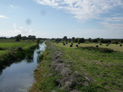
 Drainage ditches keep land dry enough to be farmed; pumps move water around
Future Landscapes
Somerset Levels and Moors - 2060
Somerset Levels and Moors Landscape - as it is today:
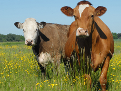
Due to the flood risk on the low lying Levels the land use is dominated by grassland grazed by sheep and cattle, though some arable production is present on land that can be kept drier. Land is drained via numerous open drains maintained by internal drainage boards in the area; the ditches are linked to a number of main Environment Agency pumping stations towards the coast via a network of water level control structures. In certain areas the water levels are now being managed on a seasonal basis for wildlife conservation purposes (mostly for wetland and wet grassland interests).
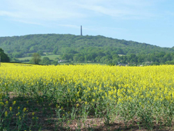
On the higher surrounding hills there is a much greater range of land uses present– including arable crops, grassland, woodland and dispersed settlements.
Upland
Somerset Levels and Moors
Lowland Coastal
![]() Project delivered by JBA ConsultingImage Copyright Information
Project delivered by JBA ConsultingImage Copyright Information
![]() Website designed & built by The Fuse Creative Marketing
Website designed & built by The Fuse Creative Marketing
Any enquiries on flood risk management activities within the Somerset WAVE area should be addressed to the Environment Agency: SouthWestEnquiries@environment-agency.co.uk
Any enquiries on other aspects of the web site should be addresses to JBA Consulting: somersetwave@jbaconsulting.com